 Pass the Exam Easily with Detailed 3-Level Practice | 1-Day Full Access Free — Offer Ends in


Vägvisningsskyltar
- 1/25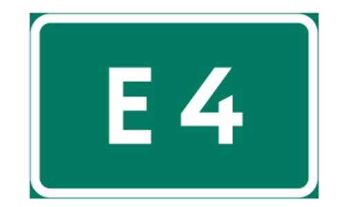
It means a road number. This sign indicates that the road you are on is the E4, a major route.

It indicates a diversion on route 58 when you see the Diversion sign . This sign shows that route 58 has a diversion, likely due to road conditions ahead.

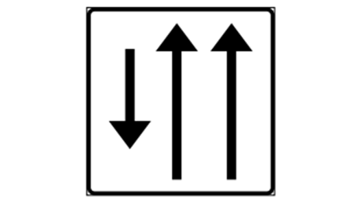
It means the number of lanes . This sign indicates the number of lanes available on the road ahead, helping drivers prepare for lane changes.

It indicates the end of lanes when you see the Lane ends sign . This sign shows that the number of lanes is reducing, and drivers should merge accordingly.
It means a lane separation on this section . This sign indicates that the lanes are separated, often by a physical barrier, for safety or traffic flow.
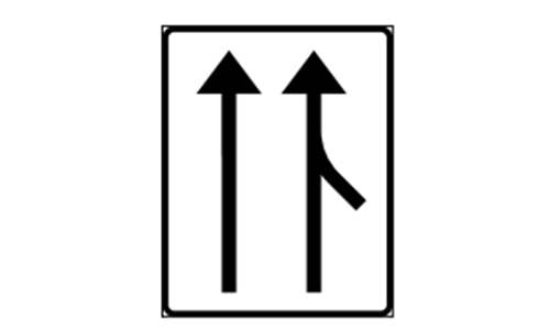
It indicates a connecting road with an acceleration lane when you see the Connecting road with acceleration lane sign . This sign shows that there is a merging road with a lane for accelerating to match traffic speed.

It means a connecting road in a separate lane . This sign indicates that the connecting road has its own lane, separated from the main flow of traffic.
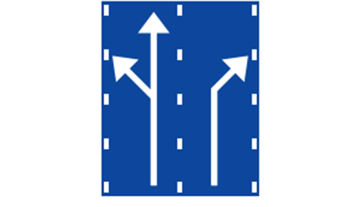
It indicates a lane division before a junction when you see the Lane division before junction sign . This sign shows how lanes split before a junction, helping drivers choose the correct lane.

It means a country border . This sign indicates that you are crossing into another country within the European Union.

It indicates a diversion route when you see the Diversion route sign . This sign shows an alternative route to follow, often due to road closures or construction.

It means a direction during a diversion . This sign indicates the direction to follow, in this case to the right, while on a diversion route.
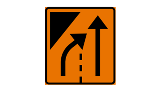
It indicates a lane is closed when you see the Lane closed sign . This sign shows that one or more lanes are closed ahead, and drivers should adjust accordingly.

It means lanes are closed . This sign indicates that multiple lanes are closed ahead, requiring drivers to merge into open lanes.
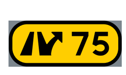
It indicates an interchange with the number 75 when you see the Interchange sign . This sign shows that you are at or approaching interchange number 75 on the road.

It indicates a parking facility when you see the Parking facility sign . This sign shows that there is a designated area nearby where vehicles can park.
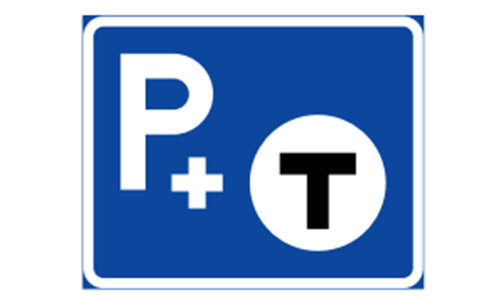
It means a park and ride facility . This sign indicates a parking area where drivers can leave their vehicles and use public transportation, like a train.
It indicates a local loop when you see the Local loop sign . This sign shows a route that loops through a local area, often for scenic or tourist purposes.

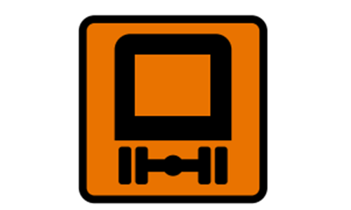
It means a sign for a certain type of vehicle . This sign provides information or directions specifically for the type of vehicle shown, such as trucks.
It indicates dangerous goods when you see the Dangerous goods sign This sign warns that the route or area may involve restrictions or hazards related to vehicles carrying dangerous goods.
It means an emergency site . This sign indicates a designated area for emergency response, such as for accidents or breakdowns.
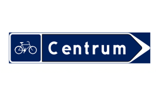
It indicates a direction for pedestrians and cyclists to Centrum when you see the Direction sign for pedestrians and cyclists . This sign shows that the city center (Centrum) is in the direction indicated for pedestrians and cyclists.
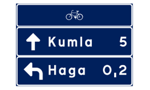
It means a direction for pedestrians and cyclists to Kunga Haga, 0.2 km away . This sign indicates that Kunga Haga is 200 meters in the direction shown for pedestrians and cyclists.

It indicates a place name like Lundby for pedestrians and cyclists when you see the Place name sign . This sign shows that you are entering or are in Lundby, specifically for pedestrian and cyclist routes.
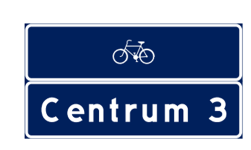
It means a direction for pedestrians and cyclists to Centrum, 3 km away . This sign indicates that the city center (Centrum) is 3 kilometers in the direction shown.
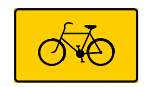
It indicates a bicycle route when you see the Bicycle route sign . This sign shows that the path or road is part of a designated bicycle route, often for longer journeys.